Project Information
Project Description:
The South Carolina Department of Tranportation (SCDOT) proposes to improve traffic safety along a high-crash section of US 76/378 (Garners Ferry Road) in Richland County, between Horrell Hill Road and the Sumter County line.
The department has identified safety concerns along this stretch of Garners Ferry and while we have identified some potential solutions, we are seeking public input on these measures before moving towards design and construction. Also, we will be using public input as one element in prioritizing which improvements move forward to implementation.
Proposed Improvements:
Potential safety improvement design concepts include the addition of concrete medians, dedicated left-turn lanes, right-in/right-out turns, and restricted crossing U-turns (RCUTs).
Purpose and Need:
The purpose of this project is to improve safety through engineering solutions identified to reduce the frequency and severity of crashes.
The need for the project was identified through traffic data collection and historic crash reporting.
Project Locations:
Click on each location below to read about the potential safety improvements
Blue Johnson to Fox Run Drive
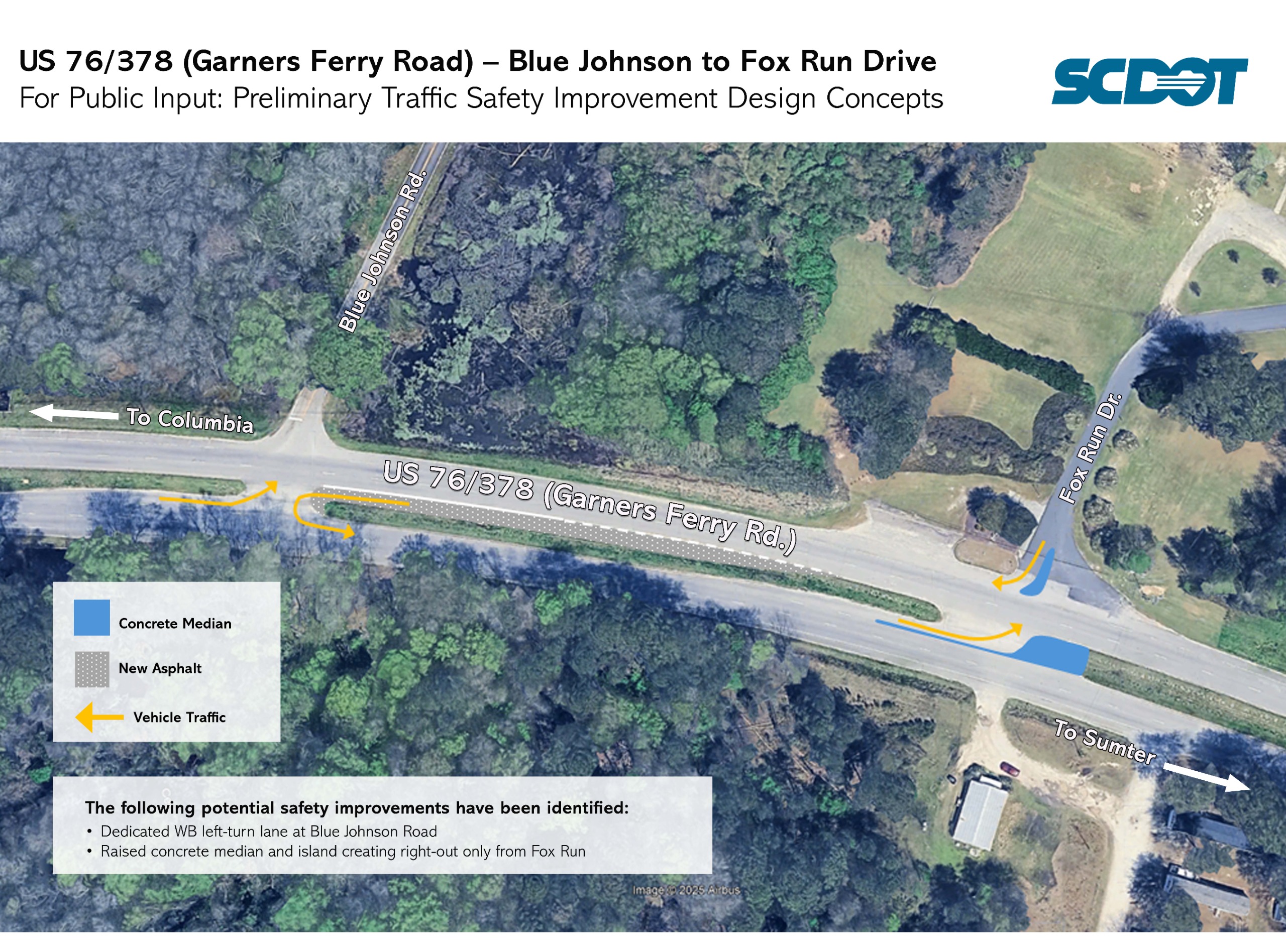
The following potential safety improvements have been identified:
- Dedicated WB left-turn lane at Blue Johnson Road
- Raised concrete median and island creating right-out only from Fox Run
Old Congaree Run (Mr. Bunky’s) and R.L. Coward Rd
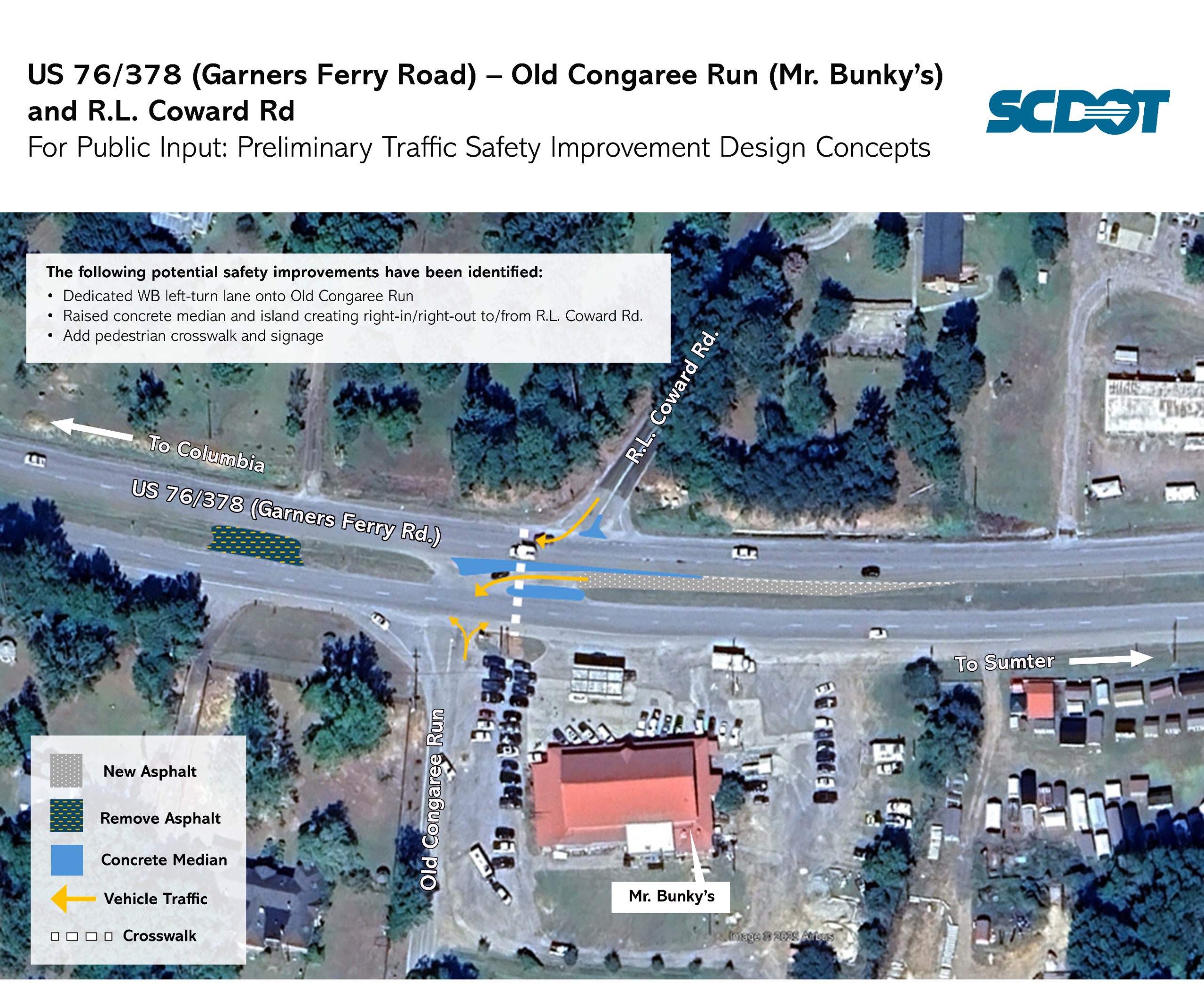
The following potential safety improvement have been identified:
- Dedicated WB left-turn lane onto Old Congaree Run
- Raised concrete median and island creating right-in/right-out to/from R.L. Coward Rd.
- Add pedestrian crosswalk and signage
Recycling Center to Louis LeConte Road
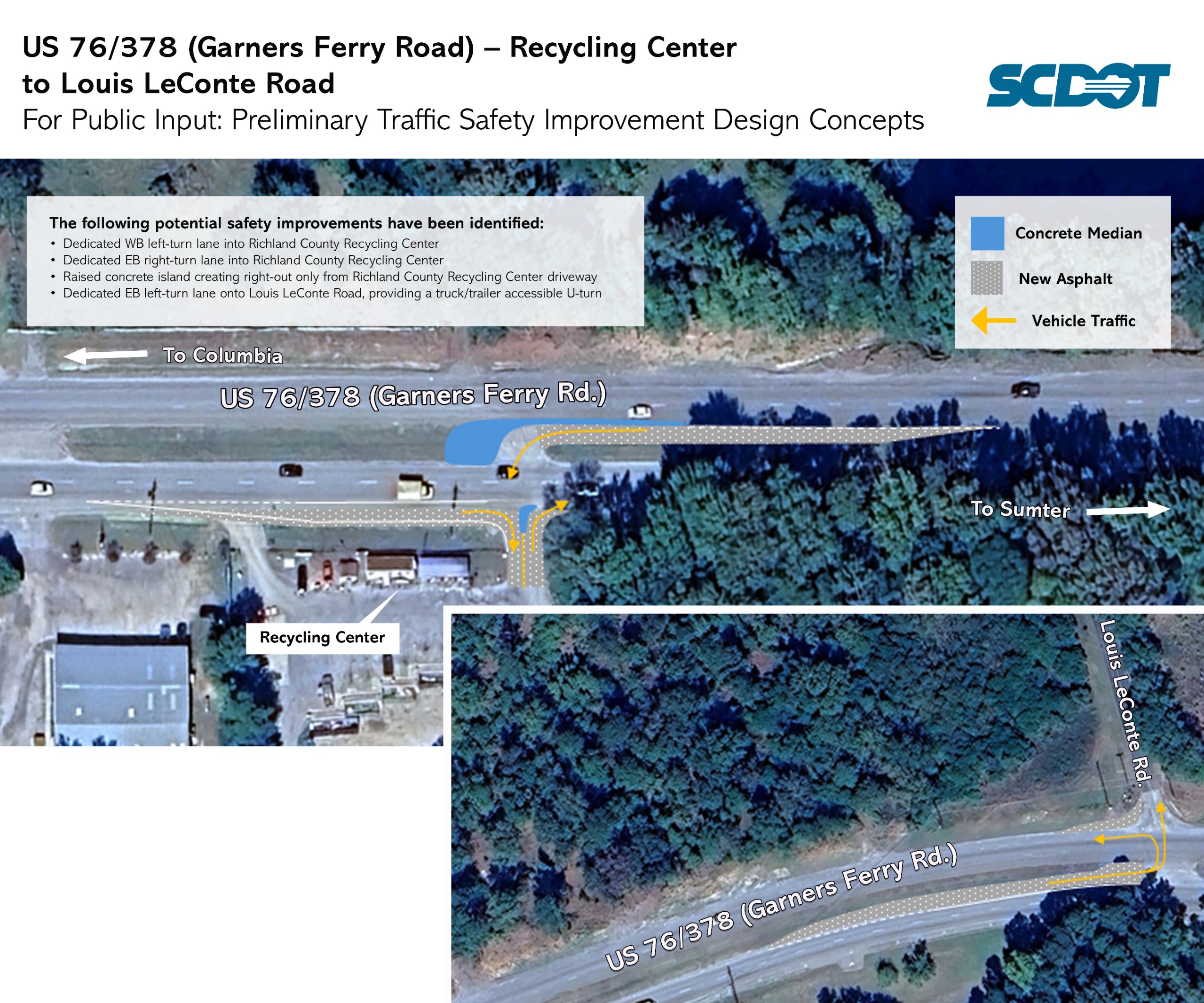
The following potential safety improvement have been identified:
- Dedicated WB left-turn lane into Richland County Recycling Center
- Dedicated EB right-turn lane into Richland County Recycling Center
- Raised concrete island creating right-out only from Richland County Recycling Center driveway
- Dedicated EB left-turn lane onto Louis LeConte Road, providing a truck/trailer accessible U-turn
Old Eastover to Congress Road/Lorenzo Davis Road
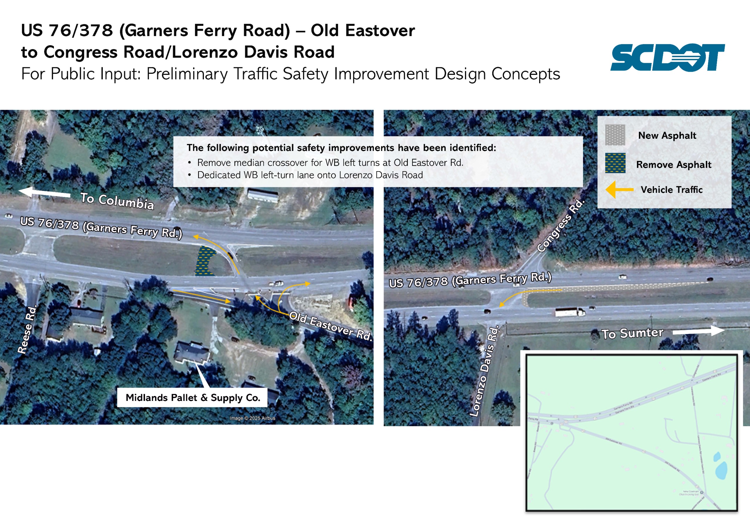
The following potential safety improvement have been identified:
- Remove median crossover for WB left turns at Old Eastover Rd.
- Dedicated WB left-turn lane onto Lorenzo Davis Road
Watermelon Hill Road to east of Piney Branch Road
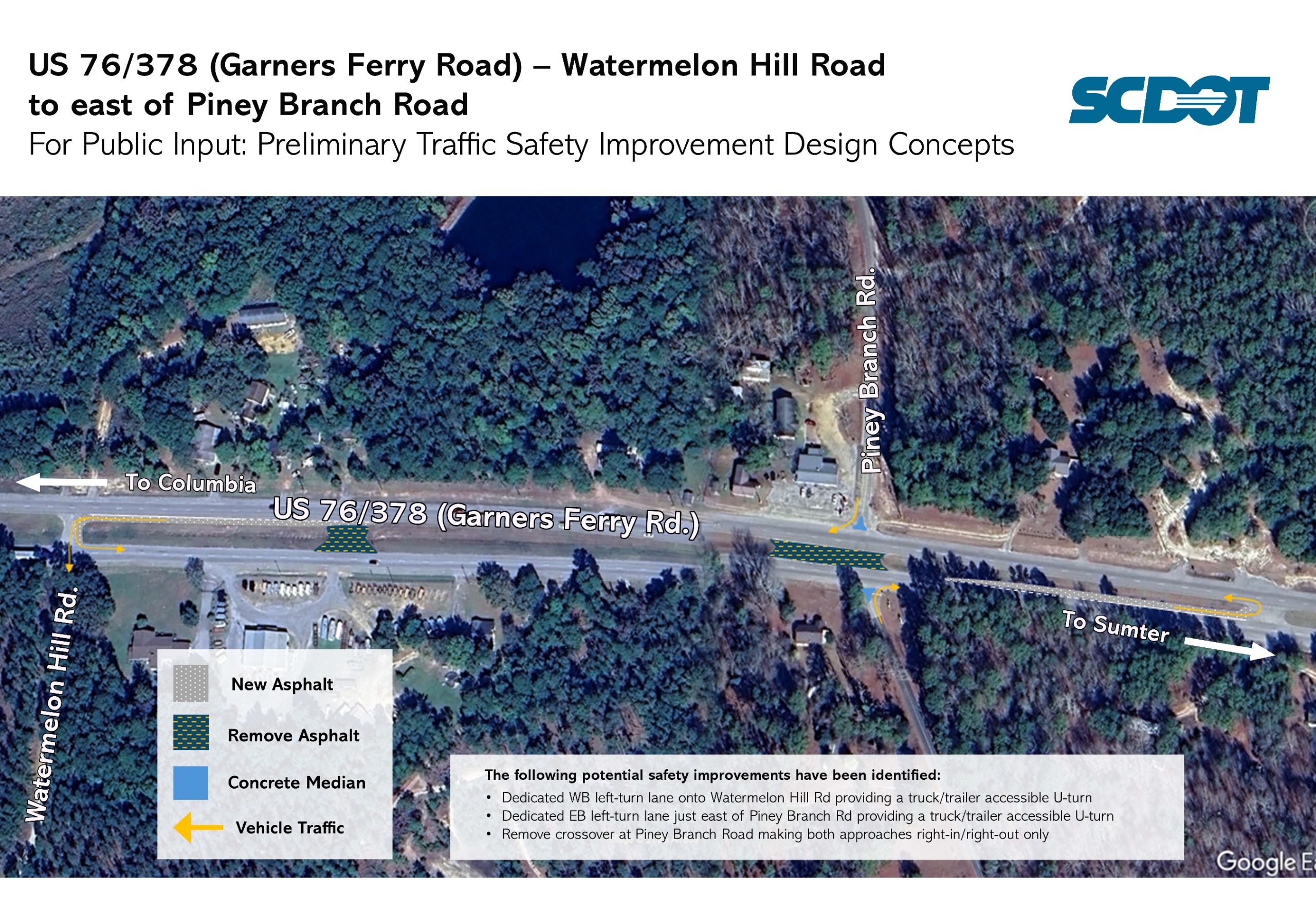
The following potential safety improvement have been identified:
- Dedicated WB left-turn lane onto Watermelon Hill Rd providing a truck/trailer accessible U-turn
- Dedicated EB left-turn lane just east of Piney Branch Rd providing a truck/trailer accessible U-turn
- Remove crossover at Piney Branch Road making both approaches right-in/right-out only
Pond Drive to Willie Wilson Rd
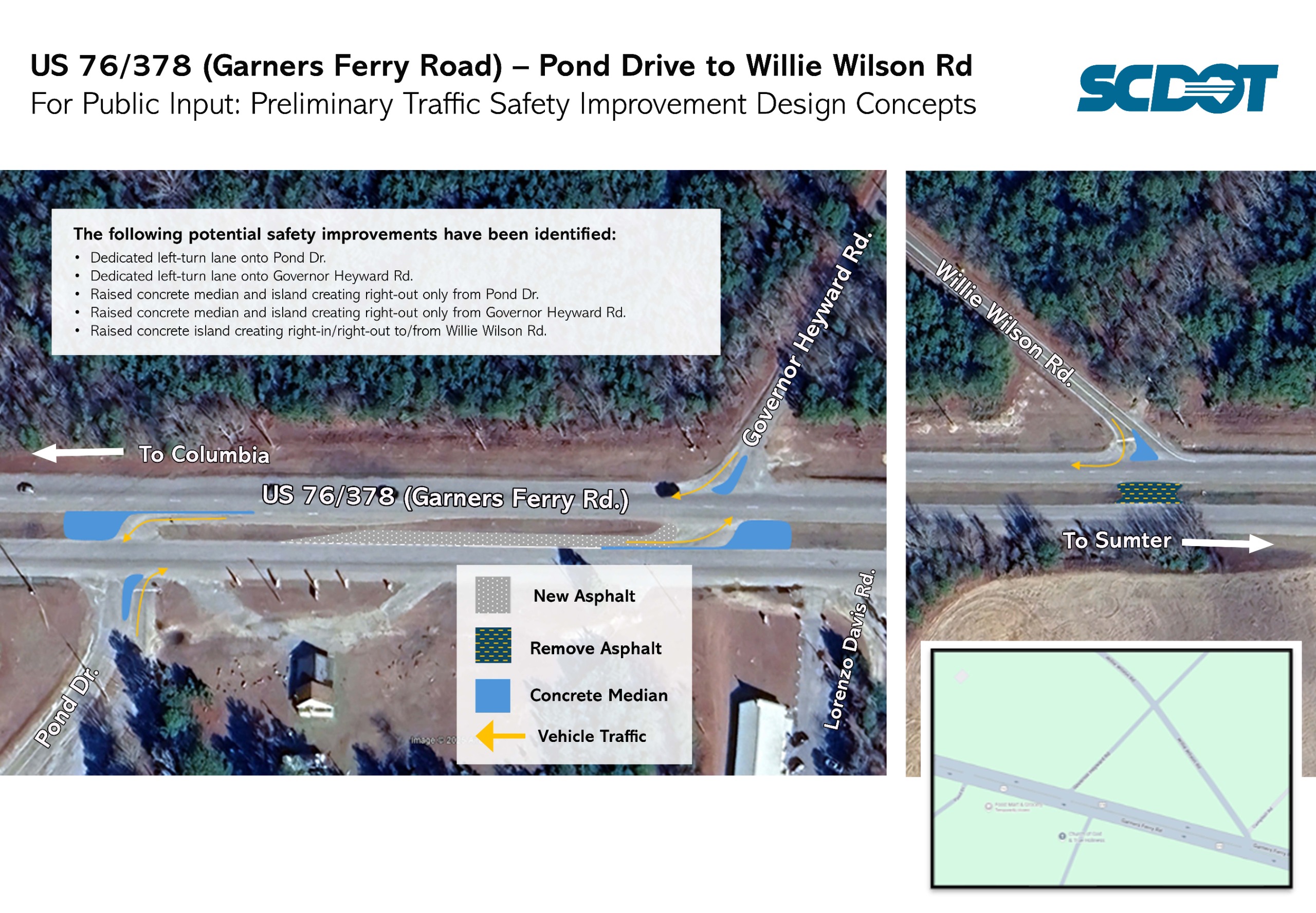
The following potential safety improvement have been identified:
- Dedicated WB left-turn lane onto Pond Dr
- Dedicated EB left-turn lane onto Governor Heyward Rd.
- Raised concrete median and island creating right-out only from Pond Dr.
- Raised concrete median and island creating right-out only from Governor Heyward Rd.
- Raised concrete island creating right-in/right-out to/from Willie Wilson Rd.
Hezekiah Rd
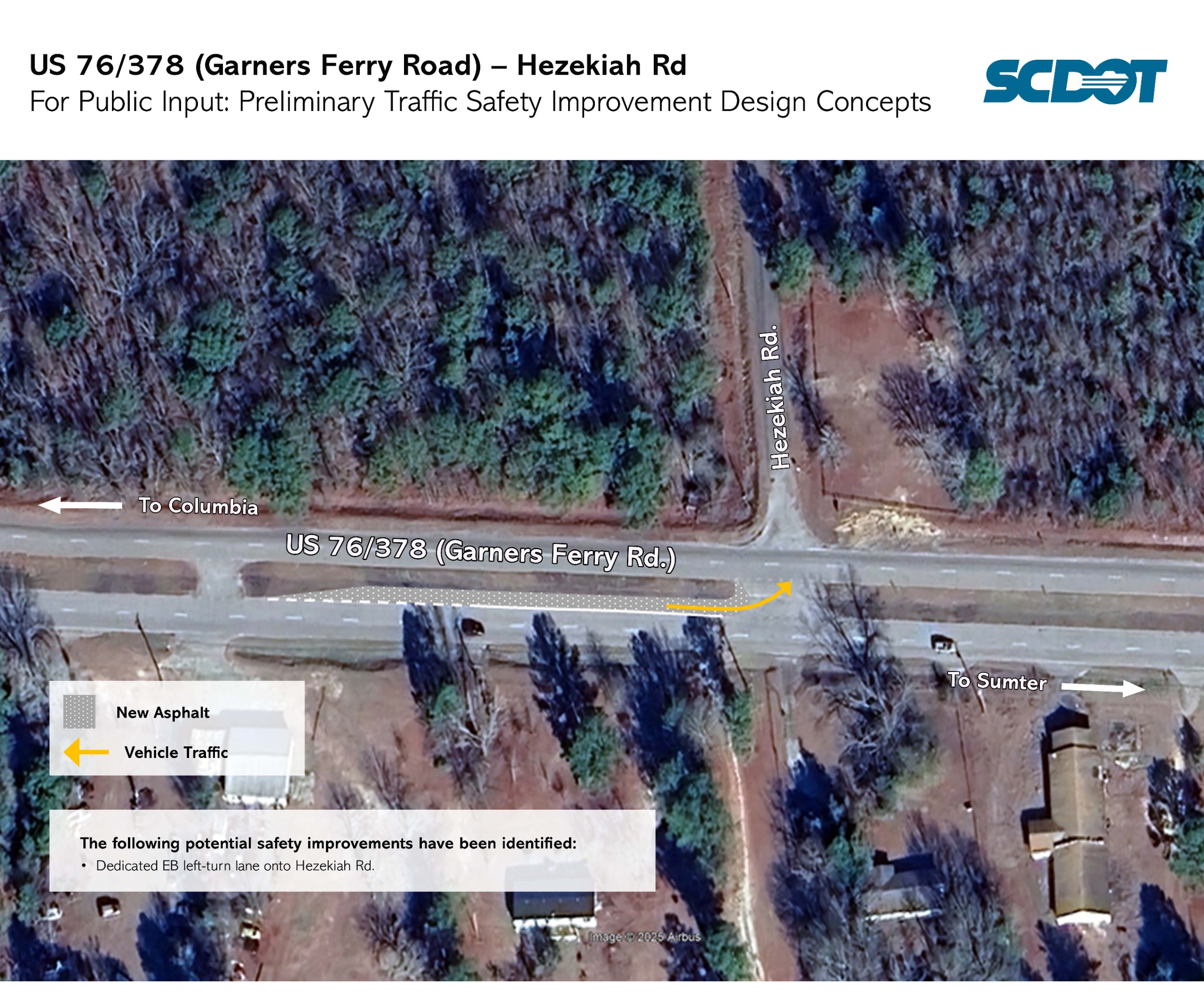
The following potential safety improvement have been identified:
- Dedicated EB left-turn lane onto Hezekiah Rd.
Feedback:
While engineering will take time, we will continue to provide updates on the progress of the project via this project page. Be sure to hit the "follow" button at the top of this page to receive direct notifications sent to your inbox. Opportunity for public comment will occur during the engineering design phase.The Comment period starts on 11/19/25 and ends on 12/19/25
Comments and feedback about this project can be submitted below!


